booryul-bah-bilya
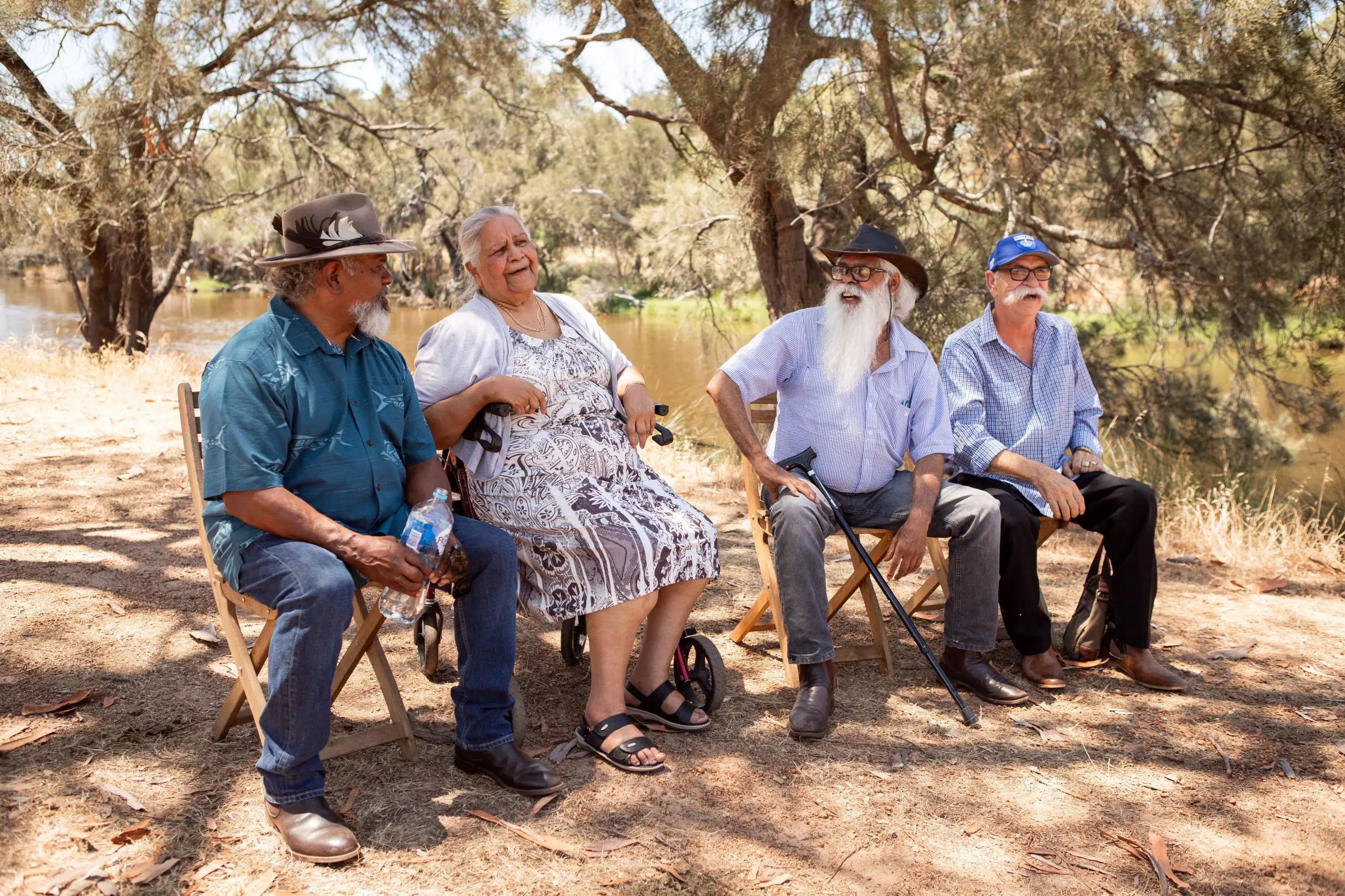
BoorYul-Bah-Bilya is our flagship initiative that aims to address declining river health by creating a new type of community catchment plan.
The program’s first plan focuses on the Mandoon Bilya, or Helena River, near Perth. However, we hope to have far-reaching impacts by creating a model that can be applied to any river.
Through BoorYul-Bah-Bilya, we hope to create transformative change for all rivers and a legacy for all Australians.
MANDOON BILYA (HELENA RIVER) CATCHMENT
The Mandoon Bilya (Helena River) flows from Ballardong and Gnaala Karla Booja near York and Beverley, through Mundaring and Kalamunda in the Perth Hills, down into Whadjuk Country through Midland, before joining the Derbarl Yerrigan (Swan River) in Guildford.
The Mandoon Bilya catchment includes six local government areas: Swan, Mundaring, Kalamunda, York, Beverley and Northam, with small areas also located in Armadale and Wandering.
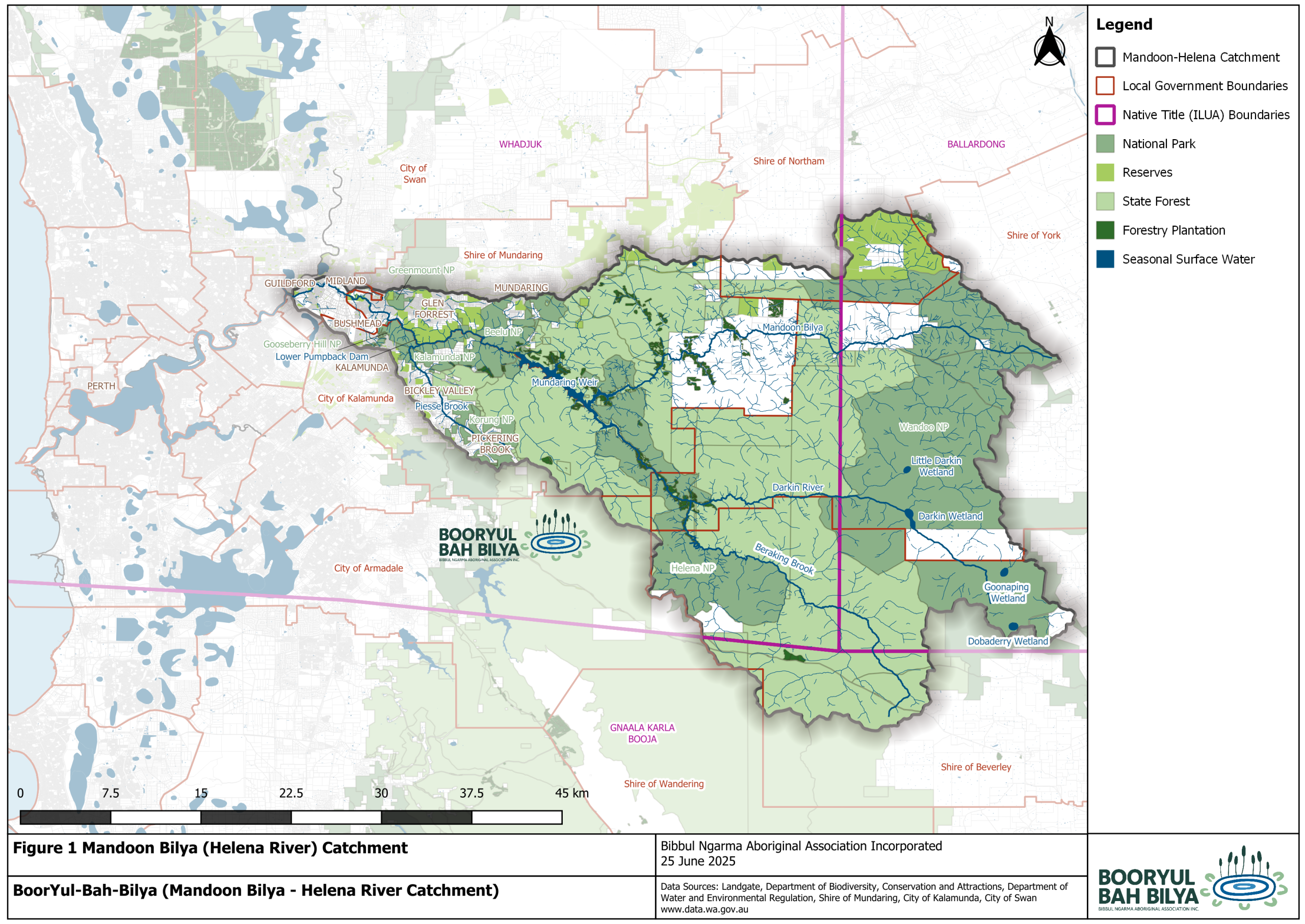
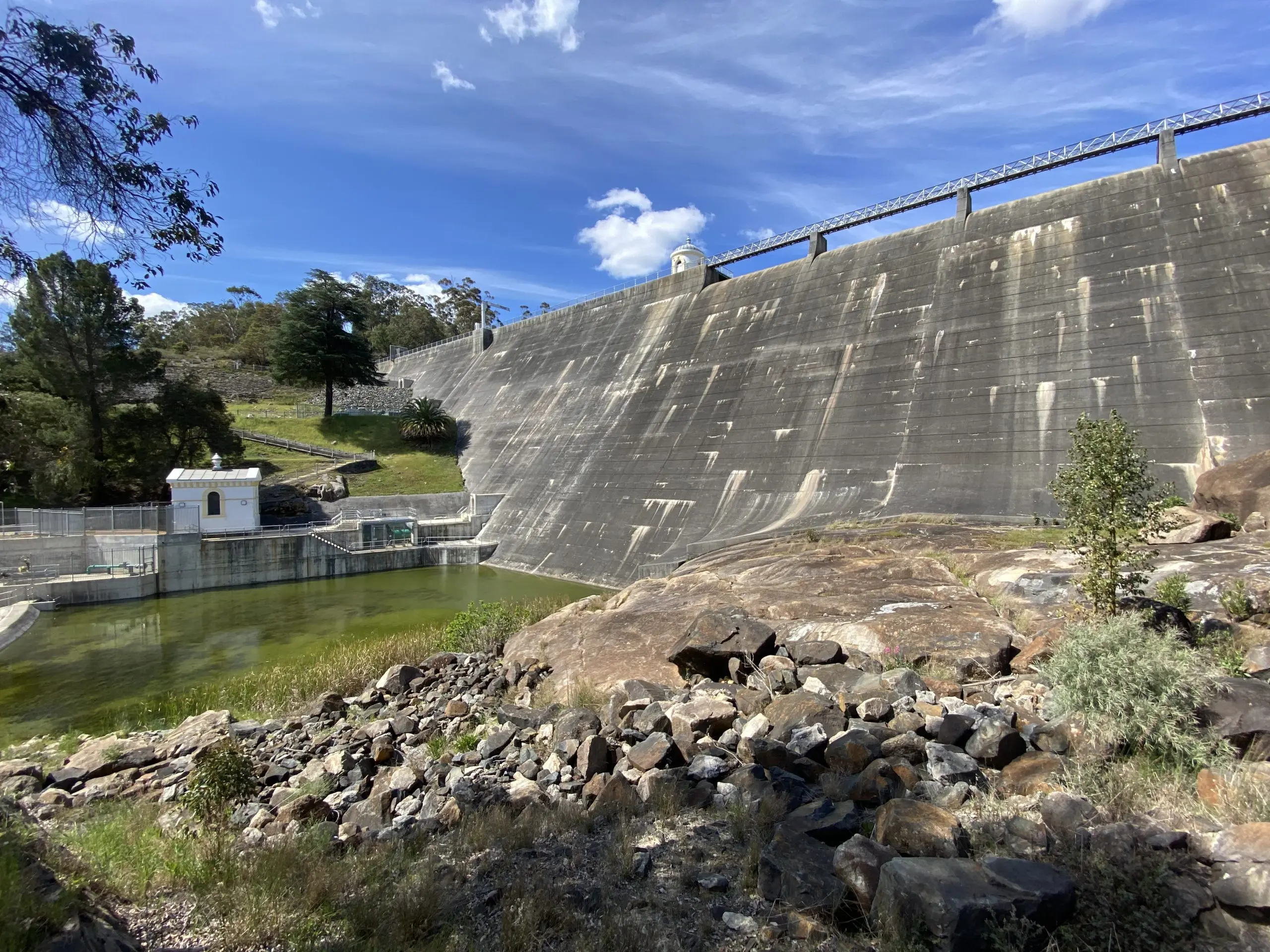
Mandoon catchment has two major dams, Mundaring Weir and the Lower Pumpback Dam, which supply drinking water for Perth and the Goldfields.
Mundaring Weir is located on the Mandoon Bilya (Helena River) and includes the confluences with Darkin River, Little Darkin River, Pickering Brook, Manns Gully, Hay Creek and other small creeks.
The Lower Pumpback Dam is also located on Mandoon Bilya, approx. 11 km downstream of Mundaring Weir, and immediately downstream of the Piesse Brook confluence.
The dams divide the catchment into 3 parts: upper (upstream of Mundaring Weir); middle (between Mundaring Weir and Lower Pumpback Dam); and lower (downstream of Lower Pumpback Dam).
Water Corporation periodically release water from the lower dam. However, there are no water releases from Mundaring Weir, meaning that the middle catchment is mostly devoid of water flow. Community members and scientists have called for measures to increase water flow in the middle catchment. Restoring water flow is an important long term aim of our BoorYul-Bah-Bilya Senior Elders.
Land use in the upper catchment is mostly state forest, drinking water catchment, forestry plantations and conservation estate managed by state government agencies, with a few private properties used for agriculture and sand mining.
Land use in the middle catchment has more private residences in rural and semi-urban suburbs like Glen Forrest, Darlington and Mahogany Creek, as well as properties associated with agriculture, viticulture and tourism. This includes Piesse Brook, a major tributary that flows from Pickering Brook townsite, through Bickley Valley and Carmel in the Perth Hills tourism precinct, and into the Lower Pumpback Dam.
Most of the lower catchment has been developed for private residential, commercial and industrial use, with the river forming a thin green corridor through the suburbs of Guildford, Woodbridge, Midland, Hazelmere, Bellevue, Boya, Koongamia, Bushmead and Helena Valley.
Management of Mandoon Bilya catchment is fragmented, with responsibility shared by many state and local government agencies, each with different legislation, and a wide range of private land owners and managers.
Mandoon Bilya catchment has very high ecological, cultural and social significance.
The entire Mandoon Bilya (Helena River) is an Aboriginal heritage site with 40+ individual sites registered along its length.
The river’s lower floodplain in Hazelmere has the second oldest archaeological site in south-west Westwern Australia, dating back at least 29,000 years (Schwede, 1983).
The catchment is an important public drinking water source via Mundaring Weir, the Lower Pumpback Dam and the Golden Pipeline.
The catchment contains the trailheads for the Bibbulmun Track, Munda Biddi Trail, Kep Track and KattaMorda Heritage Trail. It also contains 6 Bibbulmun Track campsites: Hewett’s Hill, Ball Creek, Helena, Waalegh, Berakin and Mount Dale.
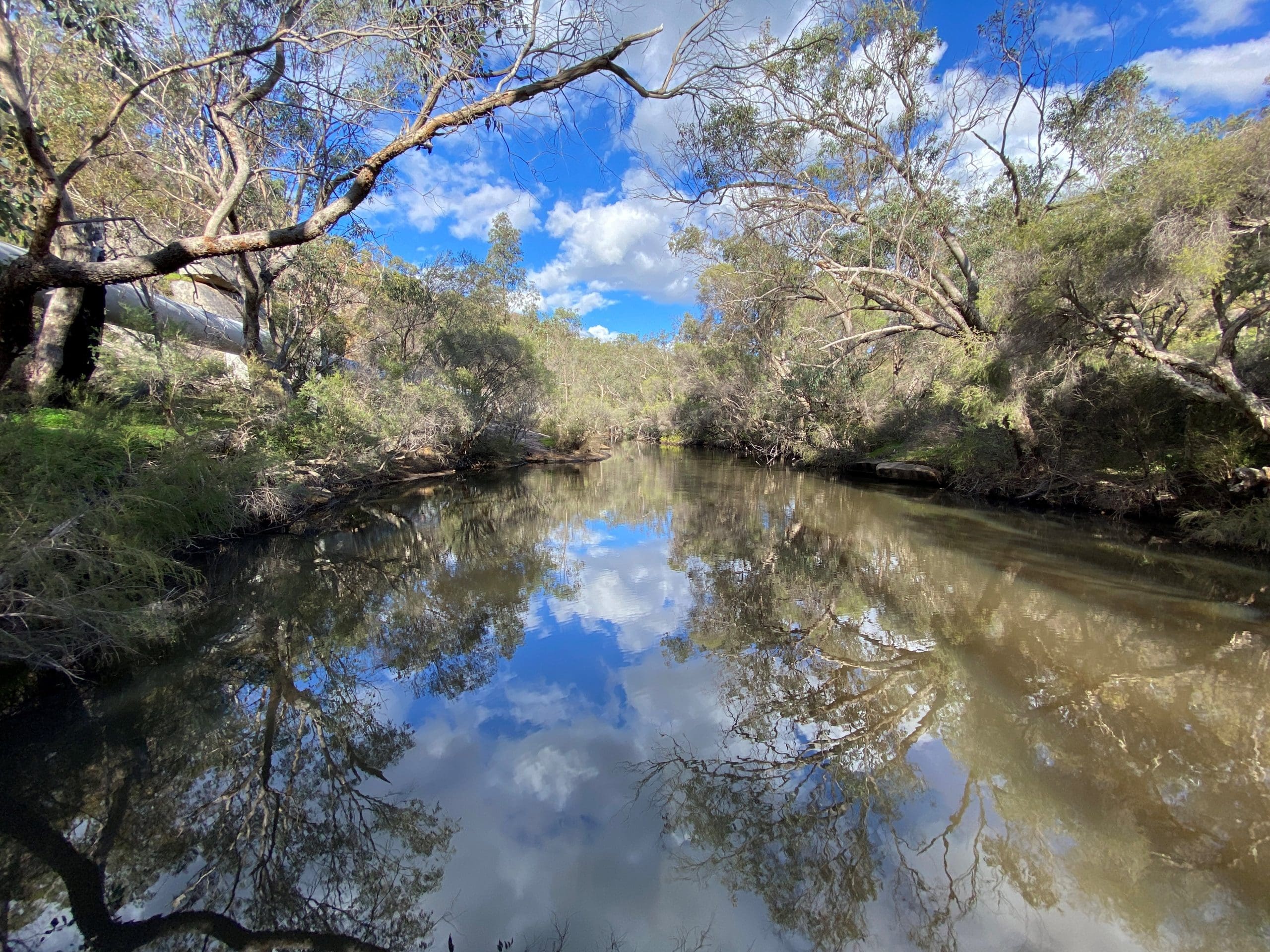
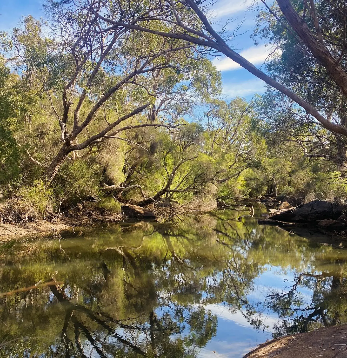
Mandoon Bilya (Helena River) is a relatively unknown river that is often overlooked compared to other Perth rivers. The catchment contains some of the last fresh waterways in Perth.
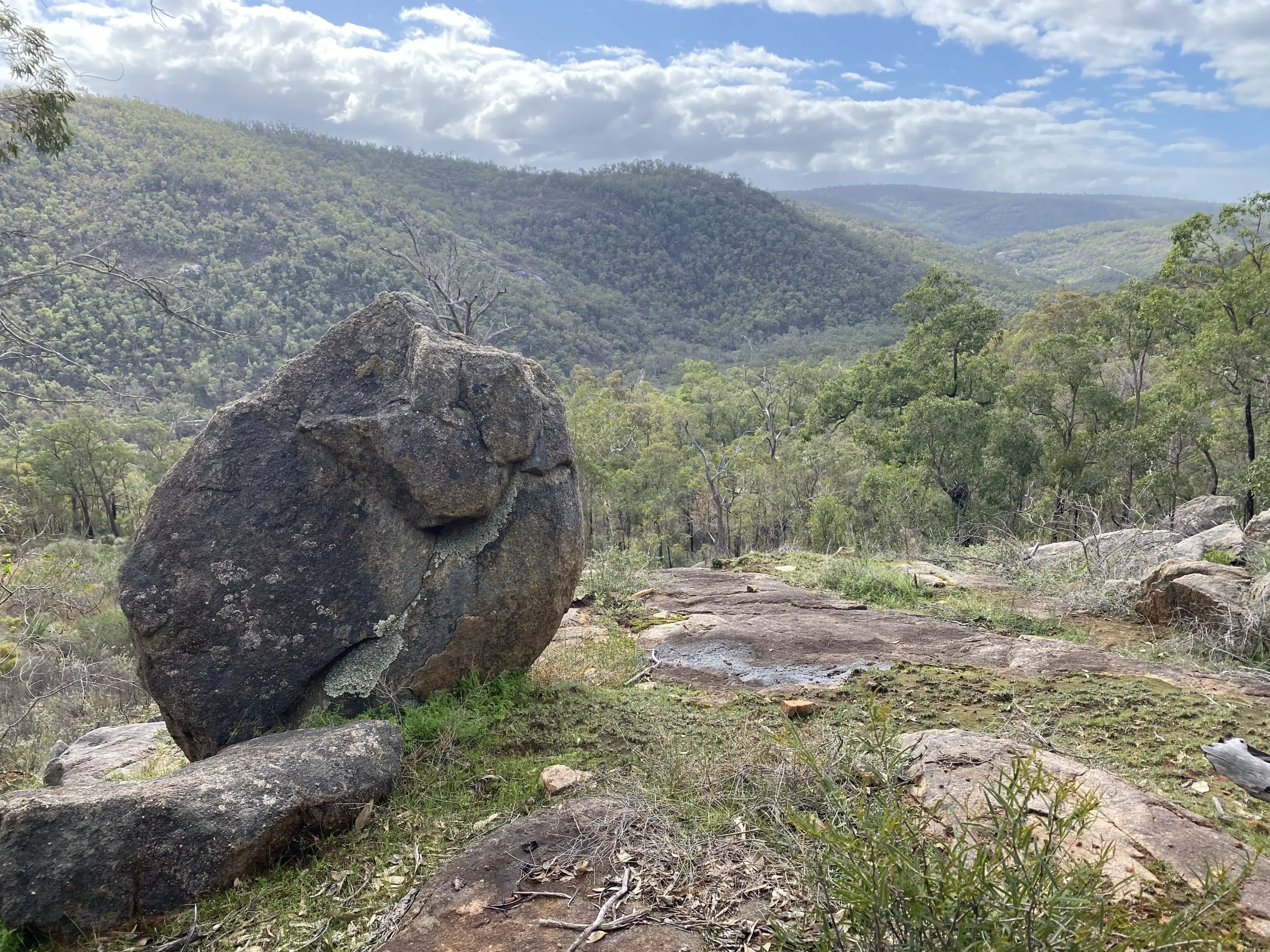
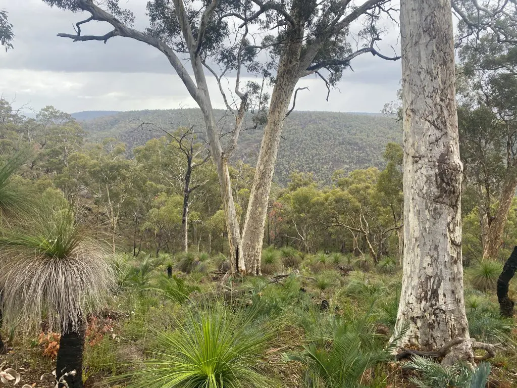
The catchment is a large and regionally significant natural space (approx. 1,655 km2) and an important biodiversity habitat.
It contains 3 biogeographic regions (Swan Coastal Plain, Jarrah Forest and Avon Wheatbelt) and 7 National Parks (Beelu, Greenmount, Gooseberry Hill, Helena, Kalamunda, Korung and Wandoo).
It is the only major river valley in Perth that is still relatively natural with large areas of forest and few sealed roads in the upper catchment.
The catchment’s granite outcrops and claypan wetlands (including Darkin, Little Darkin, Goonaping and Dobaderry), have particularly unique ecological and cultural values (DBCA, 2019; Forster, 2020).
The catchment contains some of the oldest geology in the world: Archaean granite formed 2,600 million years ago (Braimbridge & Commander, 2005).
Mandoon Bilya catchment is home to 5 threatened and protected ecological communities including the priority 4 Central Northern Darling Scarp Granite Shrubland and critically endangered Shrublands and Woodlands of the Eastern Side of the Swan Coastal Plain (McGilvray & Sylva, 2018).
It houses threatened and priority species, including numbat, quenda, chuditch, Western ringtail possum, Dell’s skink, Muir’s corella, white egret, rainbow bee-eater, peregrine falcon, Carters freshwater mussel and black cockatoos (Forest Red Tailed, Carnaby’s, Baudin’s) (McGilvray & Sylva, 2018).
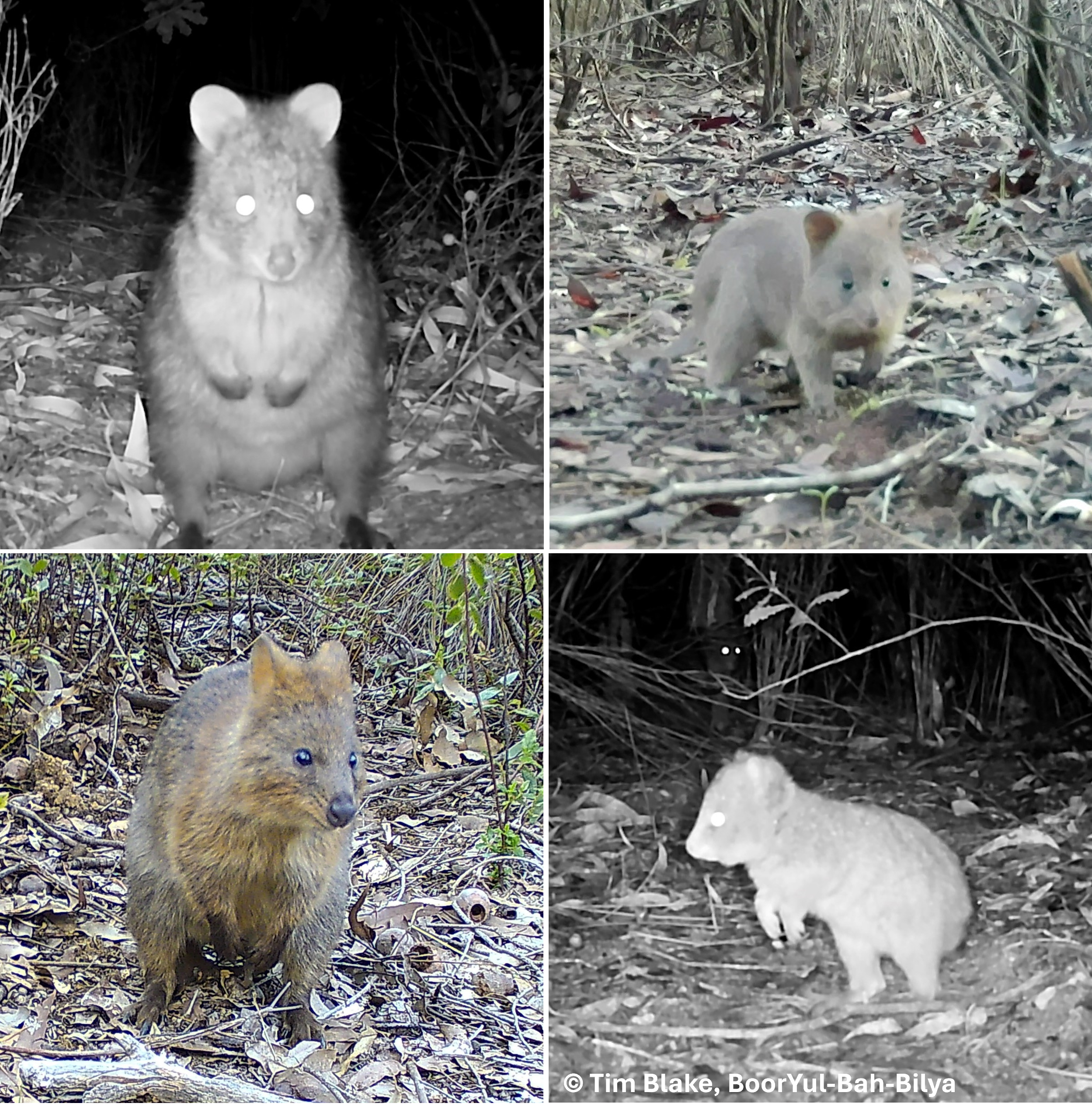
The catchment is also home to a mainland quokka population that was discovered in 2024 as part of our BoorYul-Bah-Bilya program (BNAA, 2024). This is the first time that quokkas have been photographed in this part of the Perth Hills and is an important finding for conservation of the species.
Quokkas were once abundant in this area but have reduced dramatically since the 1930s, likely due to foxes and land clearing for agriculture and mining. In the 1920s, quokkas were considered a pest of pine plantations and farms near Perth and were actively hunted and poisoned.
Current threats to quokkas include predation by foxes and cats; habitat loss due to land clearing, Phytophthora dieback and destruction by feral pigs; increased bushfire intensity and burning of wetlands and creeks; and reduced rainfall and drying of wetland habitats.
Noongar people are the Traditional Owners of this boodjar (land) and its bilyas (rivers), as recognised by the South West Native Title Settlement.
Mandoon Bilya catchment covers 3 Noongar Indigenous Land Use Agreement areas. Most is within Whadjuk country, with the easternmost portion in Ballardong country and the southernmost in Gnaala Karla Booja.
There are many Noongar names for the land and waterways that are now commonly known as ‘’Helena River’’. In Guildford, where the river flows into the Derbarl Yerrigan (Swan River), it is “Mandoon” or “place of many trees”.
The river is highly significant to Noongar people, who have occupied its banks and floodplains since time began (Flynn & Ugle, 2023). In Noongar culture, the river was formed by the Wagyl, the Great Creation Spirit.
The river continues to sustain Noongar people with water, food, medicine and an important connection from Whadjuk to Ballardong country.
REFERENCES
Schwede, M L (1983) Super Trench – Phase 2: A Report on Excavation Results. in Archaeology at ANZAAS 1983 53–62.
Please let us know if any of these links are broken or if you’re looking for a specific document – we may be able to help!
We have a unique opportunity to change the future for Australian rivers but we need your help.
The more people complete our survey, the stronger our plan will be. We want to hear from everyone!